Before and After the Bomb: an Interactive Tour of Nagasaki

Translations
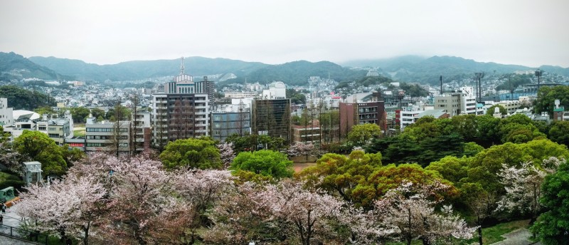
Atomic Bomb Epicenter in 2015 – Urakami, Nagasaki. Photo by Nevin Thompson.
The Nagasaki Archive has used Google Earth to create an interactive map of Nagasaki before and after an atomic bomb was dropped on the southwestern Japanese city on August 9, 1945.
The web tool essentially collects and curates information from around the web, matching survivor stories on YouTube, for example, with the precise location where these individuals were in Nagasaki when the bomb detonated.
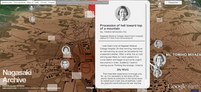
The Google Earth plugin for Windows or Mac OSX 10.6+ is required to run the Nagasaki Archive.
The site also features similar web tools that explore the atomic bombing of Hiroshima, as well as the bloody Battle of Okinawa earlier in 1945 that saw up to 150,000 civilians killed.


4 comments